|
|
Topic Originator: OzPar
Date: Thu 3 Oct 11:18
I still have quite a collection of Ordnance Survey maps dating mostly from the 1970s and 80s when I was a regular walker of the Scottish hills and the English countryside. Looking at them now, 30 and 40 years on, brings back fond memories of favourite spots, of days out with friends and family (some sadly no longer with us) and of innocent pleasures like eating packed sandwiches washed down with Cremola Foam mixed with water taken from a mountain burn.
It was an item on the news today that put all this in my mind. The Australian equivalent of the OS, Geoscience Australia, has announced that in December it will cease to print paper maps as people are longer buying them, opting instead to use Google Maps or GPS navigation.
A sign of the times, I suppose, but it's sad nonetheless. I suppose the sheer numbers of visitors to Britain's countryside will keep sales of OS maps going for a while longer, but inevitably the electronic devices will kill off the paper maps in the UK too.
Which is all well and good until the battery on your GPS or phone runs out of power. Then you might begin to wish that you still had that paper map in your rucksack...
|
|
|
|
|
|
Topic Originator: dave67
Date: Thu 3 Oct 11:27
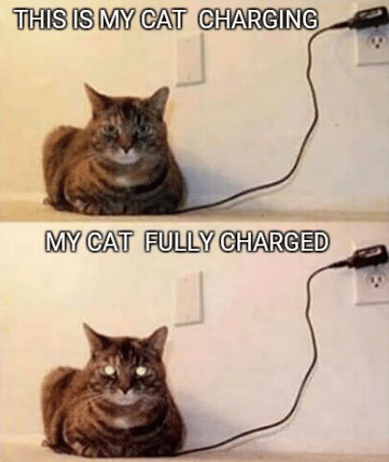
Take a charger with you
|
|
|
|
|
|
Topic Originator: Skerla
Date: Thu 3 Oct 12:05
Aye just plug it into the side of Ben Nevis or a tree.
|
|
|
|
|
|
Topic Originator: widtink
Date: Thu 3 Oct 12:09
You do realise that sheep (other animals are available) sometimes do their "business" in mountain burns and streams 🤣 🤮
Admin

|
|
|
|
|
|
Topic Originator: General Zod
Date: Thu 3 Oct 12:10
You can buy battery chargers that plug via usb to phone or whatever. They’re cheap and can fully charge a phone something like 4 times.
|
|
|
|
|
|
Topic Originator: parak obama
Date: Thu 3 Oct 12:57
Quote:
widtink, Thu 3 Oct 12:09
You do realise that sheep (other animals are available)
Thought you meant to plug a charger into 🤣
[IMG]https://share2.co.uk/f/1152_471_P300411_16.49_[02].jpg[/IMG]
|
|
|
|
|
|
Topic Originator: widtink
Date: Thu 3 Oct 15:02
Like this? 🤣

Admin

|
|
|
|
|
|
Topic Originator: Socks
Date: Thu 3 Oct 23:16
I love maps, and I can quite easily pass an hour or two staring at one of the pink OS maps, looking at things in some remote area of the country in real detail.
Given that, it's sad to hear of the end of paper maps in Australia. Regardless of how good technology is, when away in the hills I would always want a paper map and for safety I always take map, compass and whistle. Navigation using map and compass is a very useful skill and if technology improvements mean fewer people can do this, that is not a good thing. I work in electronics, and so I know that electronics fail and software fails. Part of that is due ot the constant demands for decreases in price and physical size - making things smaller and cheaper is convenient, but reliability can be degraded. For most consumer items that's OK, but not great if you're relying on it to get off a hill in a whiteout.
Google maps will guide you along decent roads and tracks, but I'm not sure how useful it is when away from those. The OS maps just have so much more information, and I'll certainly be using them for as long as they're available. On the last one I bought, I noticed that when buying the map you also get a license to download the electronic equivalent, allowing you to see all the OS map data on a mobile device as well.
|
|
|
|
|
|
Topic Originator: Aylesbury_Par
Date: Thu 3 Oct 23:33
If you like poring over maps then be prepared to lose days of your life with the side by side viewer on this link which lets you compare current day maps alongside historical versions through different time frames:-
https://maps.nls.uk/
It can be fascinating refreshing your memory of how things were, you can even see exactly where the 2 pubs that used to be on the way to EEP that are frequently brought up on here!
|
|
|
|
|
|
Topic Originator: EastEndBoy
Date: Fri 4 Oct 08:56
Quote:
Aylesbury_Par, Thu 3 Oct 23:33
If you like poring over maps then be prepared to lose days of your life with the side by side viewer on this link which lets you compare current day maps alongside historical versions through different time frames:-
https://maps.nls.uk/
It can be fascinating refreshing your memory of how things were, you can even see exactly where the 2 pubs that used to be on the way to EEP that are frequently brought up on here!
Thats awesome. That's my morning sorted.
Anyone player geoguessr?
Click here
I've lost hours on this before.
...ken?
|
|
|
|
|
|
Topic Originator: veteraneastender
Date: Fri 4 Oct 10:47
I used to order OS maps from a source in Dunfermline, can't recall the name now.
They could supply them rolled and laminated which was ideal for pinning to a wall for teaching.
The 1:25.000 Pathfinder series were great for DofE.
DofE refused to permit the use of electronic devices on expeditions - any kids who tried to circumvent this condition would fail if discovered.
Not sure if that prohibition is still the case, I suspect it is though.
|
|
|
|
|
|

